Brioude ancient walls |
|||
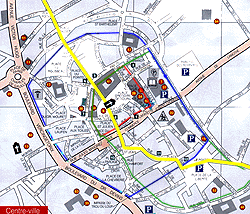 |
in red : claustral enceintes in green : walls of 9th and 10th century in blue : walls of 13th century in yellow : North-South road |
Please note that the basilicat was fortified but is not
part of the city walls. Also note that the road was crossing the basilica. |
|
| d'après le plan de Brioude des imprimeries Watel et l'article de R. Gervais,"Les fortifications de Brioude Documents et Recherches", Almanach de Brioude 1980, page 150. | |||
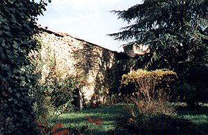 Photo Michel BARDEL |
There are a few remains of the wall around the town. Here north-west of the 13th century wall, J.J. Rousseau square. |
See a reconstruction of the north gate here. | |
| Home | History | Geography | Maps and Cards | Tourism | Living
in Brioude | Page updated on 07/03/2004
|
|||